
The far north of South Africa — where gold, ivory, salt and glass beads once moved between the interior kingdoms & queendoms and the Indian Ocean World.
For centuries, gold, ivory and glass beads moved along the rivers of South Africa's far north, linking the interior to the Indian Ocean and the wider world. This is where that trade first emerges clearly as a kingdom connected to the Indian Ocean world, and this guided journey follows the ancient corridor through the places it left behind.
The route runs through the vanished gold kingdom of Mapungubwe, the stone citadel of Thulamela, the ivory-trail crossroads of Crooks Corner, the Iron Age furnaces of Masorini and the old trading post at Albasini — and through the living kingdom of the Venda, where that world is still alive today.
Along the way it is also great wildlife and greater country: the big-game landscape around Mapungubwe, the Greater Kruger and Manyeleti, and the escarpment views of the Panorama Route. These are places that lie past the airstrips, reached by road, where the land between them is part of the journey rather than something to fly over — and where we travel with you, guiding the way through country we have known for over twenty-five years.
The gold and ivory of Mapungubwe did not stay in the south. They travelled north along the rivers and out across the Indian Ocean, part of a trade network that reached from the Limpopo to Zanzibar and beyond. This journey follows that network at its source. It is the southern origin of the wider Ancient Trade Routes, and it can be read alongside the other Southern Cross routes that carry and travel the story onward. That same trade, over the centuries, also gave rise to the trade in human beings, a separate and harder history that Southern Cross carries as its own on its Routes of Remembrance.
The gold and ivory that left Mapungubwe, Great Zimbabwe and Kilwa did not stop at the African coast. Monsoon-driven dhows carried it across the Indian Ocean, linking the interior kingdoms of southern Africa to a trading world that reached India, Arabia and, at its far end, China.

Song Dynasty celadon — the same type found at Thulamela and Kilwa, thousands of kilometres from where it was made.
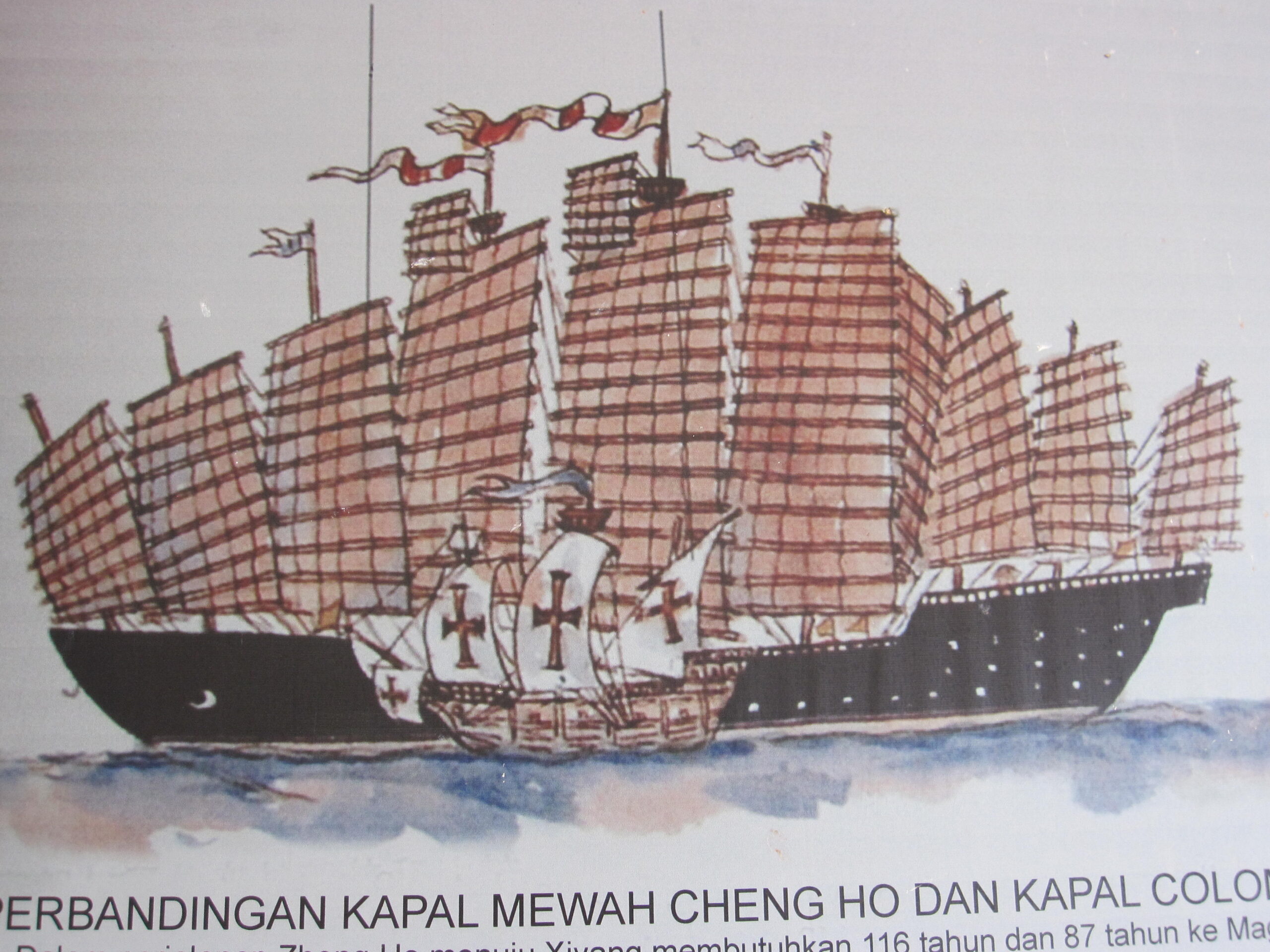
Zheng He’s treasure ship compared to Columbus’s Santa María.
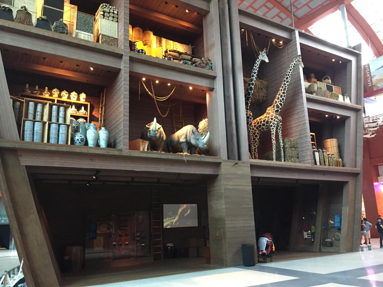
Inside a treasure ship: African ivory and celadon porcelain. Maritime Experiential Museum, Singapore.
Chinese celadon ceramics found at Thulamela, Kilwa and Great Zimbabwe point to trade links reaching back to the Song Dynasty (960–1279). The celadon was fired in kilns near Quanzhou — the port UNESCO inscribed in 2021 as “Emporium of the World in Song-Yuan China” and connected, along the Maritime Silk Roads, to the ports of the East African coast.
In the early fifteenth century the Ming admiral Zheng He reached the East African coast with his treasure fleet, trading with the coastal kingdoms and carrying ivory, and a giraffe, back to the Ming court. His ships reached the ports of present-day Kenya and Somalia, far to the north of this route.
The celadon at Thulamela predates Zheng He by two centuries. Africa’s connection to China was not a single voyage but a long maritime system, and UNESCO has inscribed both ends of it: Quanzhou (2021) and Mapungubwe (2003).
These same corridors are read today as the deep history of the maritime trade routes that China now invokes in its Belt and Road Initiative — a reminder that the Indian Ocean world this route belongs to still shapes how the continents connect.
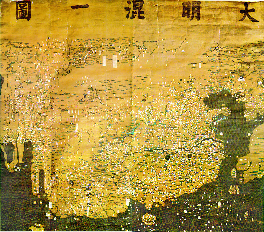
The Da Ming Hun Yi Tu (c. 1389). A digital replica was presented to the South African Parliament in 2002.
The Da Ming Hun Yi Tu, a Chinese world map from around 1389, shows the African continent pointing south, more than a century before the Portuguese rounded the Cape. Among its features are the Nile and mountains in the south that some read as the Drakensberg.
Its picture of Africa did not come from Chinese observation. It was drawn from Arab and Persian geographical knowledge that had travelled east into China along the same Indian Ocean networks that carried gold, ivory and celadon — a reminder that knowledge of this continent, like its trade, moved across the world long before Europe arrived.
Glass beads, textiles and metalwork moved into southern and eastern Africa from Gujarat and the Malabar Coast. Indian merchants were resident at Kilwa and Zanzibar for centuries.
Omani merchants controlled the Zanzibar trade from the seventeenth century. The monsoon winds that carried dhows between Arabia and East Africa also carried ivory, gold and frankincense across the western Indian Ocean.
Portuguese traders reached Sofala in 1505, drawn by the gold trade. By the nineteenth century, European demand for ivory drove the trade to its most destructive peak.
From the inland kingdoms, the gold and ivory travelled on to the coast: to Sofala, near modern Bazaruto, where it left the continent; to Kilwa Kisiwani, the island port that controlled the export; and to the Stone Town of Zanzibar, where it was weighed, priced and sold to buyers from three continents. This journey follows the southern origin of that chain. Its full northward reach, from the Limpopo to Zanzibar, is a separate Southern Cross route.
Explore the full African Ivory Trade RouteThe ivory did not move on its own. Across much of Africa, the trade in ivory was bound up with labour that was not free, and with enslavement: it was carried, often over great distances to the coast, by people who had no say in it. To tell the story of the ivory without them would be to romanticise it. We hold this history with the seriousness it asks for, separately and in full, in our Routes of Remembrance.
Enter the Routes of RemembranceThis journey follows a single thread that once connected these places, and gives each of them its meaning along the way.
Along this route lies one inscribed UNESCO World Heritage Site, Mapungubwe, and it is the source of the story — the place where the gold and ivory trade of southern Africa began, and from which a thread runs outward to Great Zimbabwe, to Kilwa, to Zanzibar, and to many of the World Heritage Sites that lie along the other Southern Cross routes.
There is a precedent for reading heritage this way. UNESCO’s Routes of Enslaved Peoples programme recognises not a single site but a connecting theme carried across many places and many countries — memory followed as a thread, rather than heritage counted as a list. This journey is built on the same principle: it follows the origin of a trade whose consequences, in time, reached across a continent and an ocean, including the harder history of enslavement that grew from it.
That is what gives this route its weight. Not the number of sites you stand before, but the understanding you carry away of how they are joined.
The Routes of Enslaved Peoples (launched by UNESCO in 1994, formerly the Slave Route Project) is a programme of research and memory, not an inscription on the World Heritage List. It is referenced here to illustrate a way of understanding heritage as a connecting thread. References to UNESCO World Heritage Sites are factual references to sites inscribed on the UNESCO World Heritage List. Southern Cross Experiences is an independent travel company and does not imply UNESCO endorsement of its journeys.
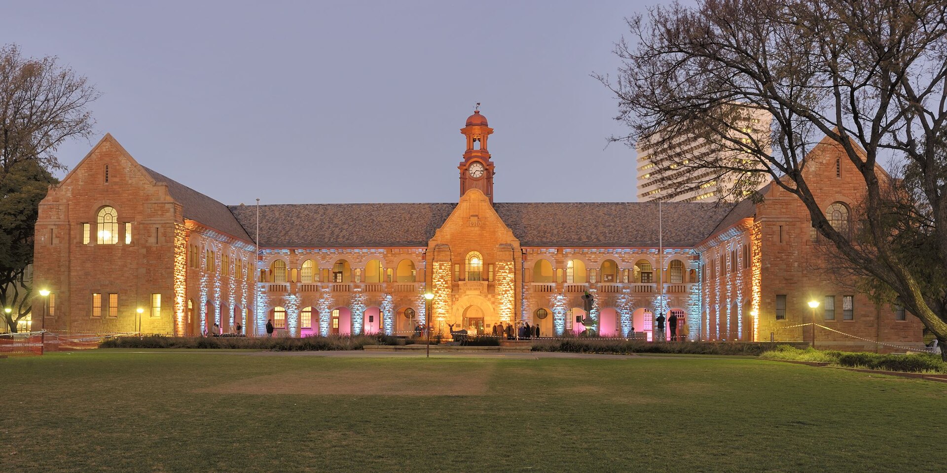
University of Pretoria Museums ¾
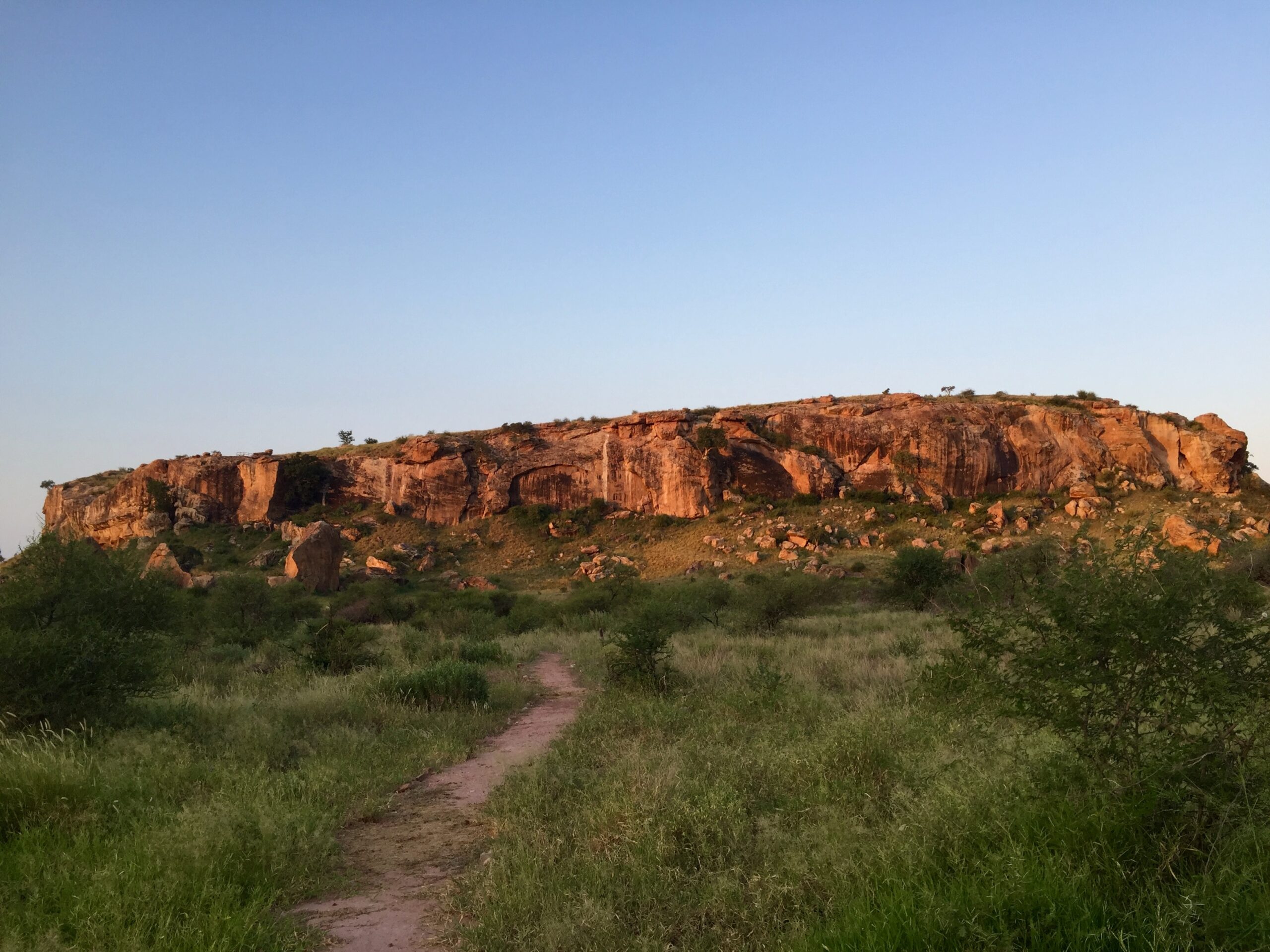
Mapungubwe Hill ¾
Mapungubwe Interpretation Centre ¾
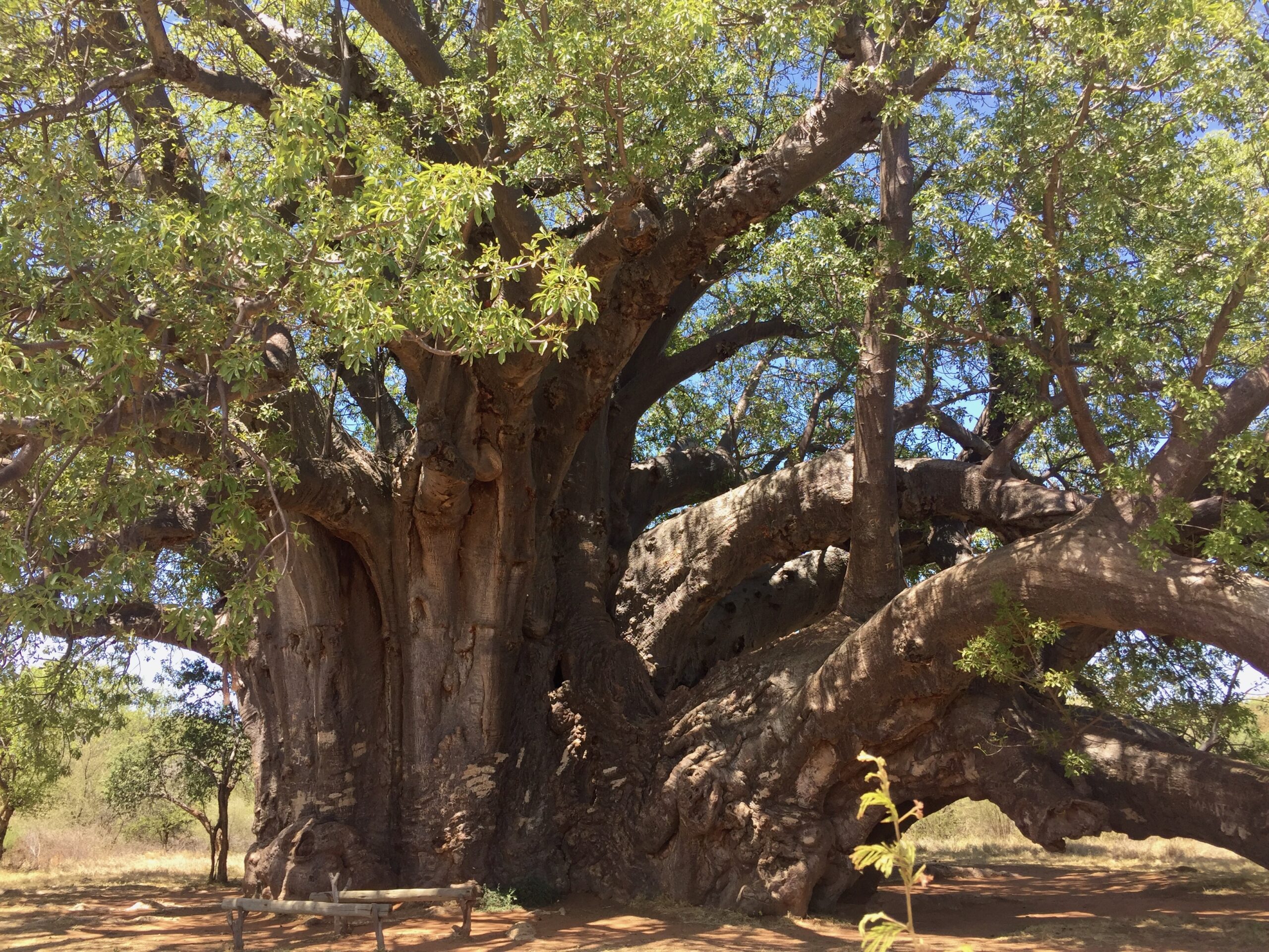
Sagole Big Tree · en route ¾

Crooks Corner · en route ¾
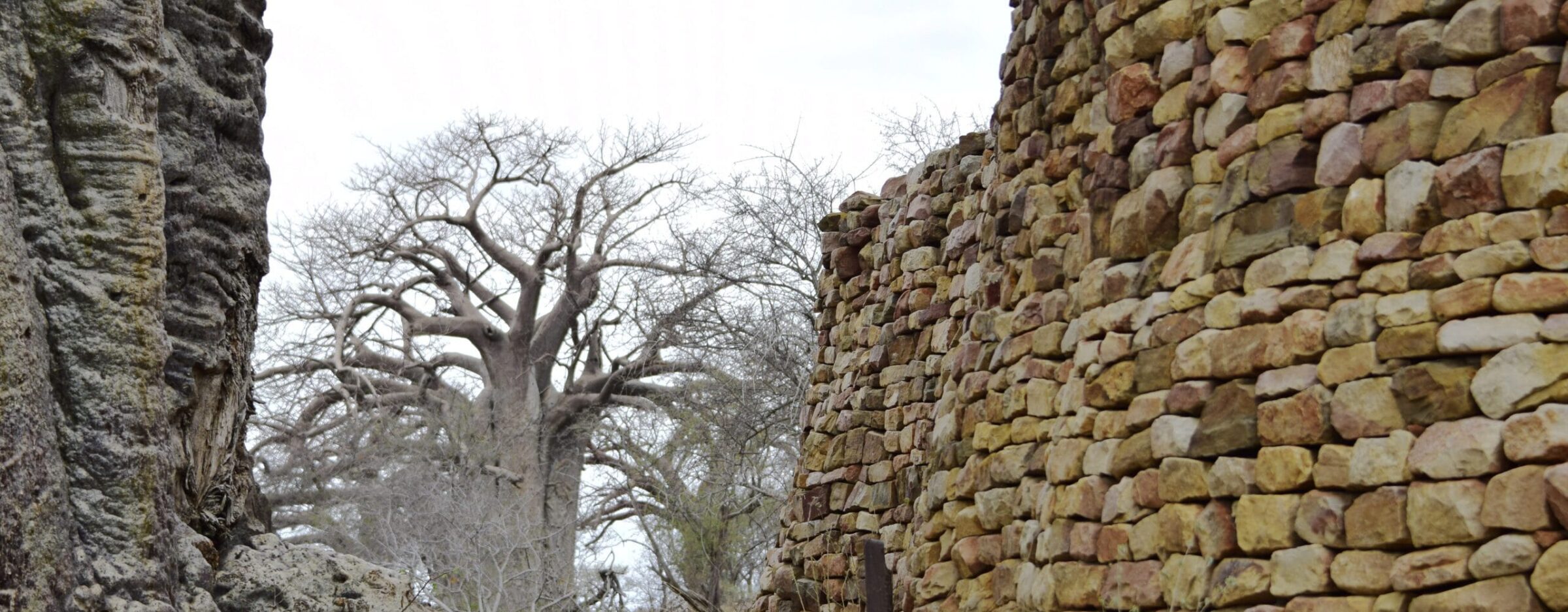
Thulamela ¾
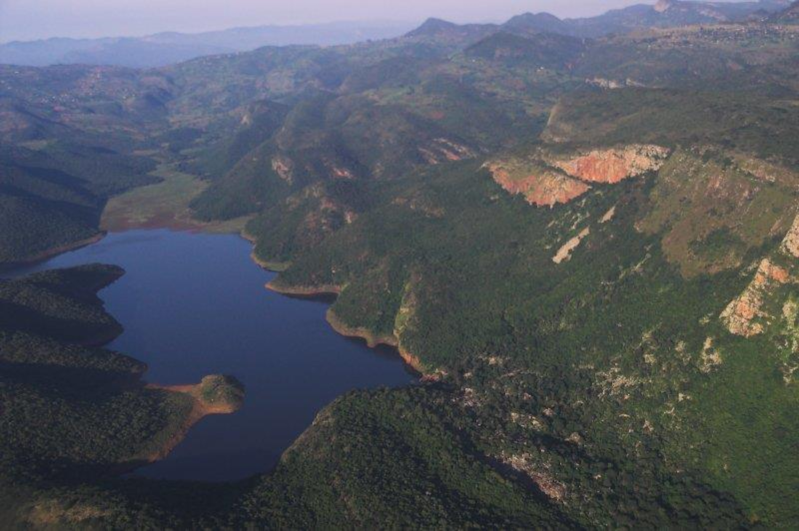
Sacred Lake Fundudzi ¾
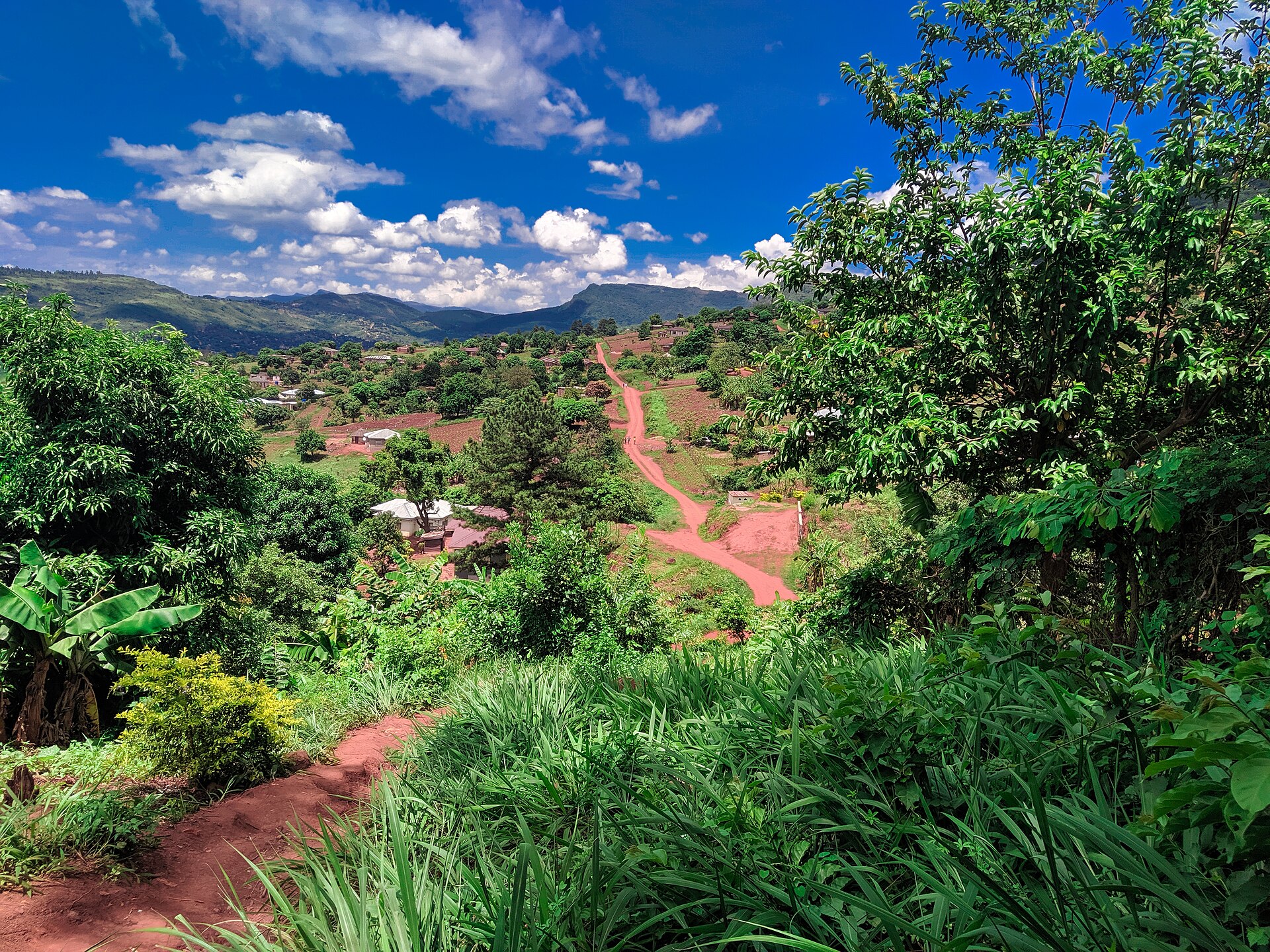
Mukumbani Village Visit ¾
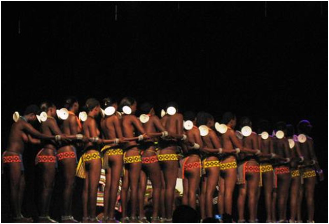
Domba Dance ¾

Baleni · en route ¾

Masorini · en route ¾

Albasini Ruins · en route ¾
Pretoria · 1 night ¾
Mapungubwe · 2 nights ¾

Pafuri & Makuleke · 2 nights ¾

Venda · 2 nights ¾
Letaba · 2 nights ¾

Manyeleti · 2 nights ¾

Panorama Route · en route ¾

Graskop · 1 night ¾
Southern Kruger · 1 night ¾

Long before Southern Cross flew travellers to the World Heritage Sites of the continent, there was this route. The African Ivory Route was developed by the Limpopo Province together with the community cooperatives who own and run its camps and cultural homesteads. From the early 2000s, Southern Cross helped bring it to life as a heritage journey, developed the way we believed heritage travel should be: on the ground, with the people whose heritage it carries, and with the University of Pretoria. This is the southern origin of a wider circle of historic trade routes that Southern Cross has since shaped into journeys you can travel.
It taught us the method we still work by, that heritage is understood, not just visited; that a place is opened by the people who hold it, not bought; that the deepest journeys are guided by those who know the ground. Our founder, Doris Wörfel, initiated and led that work.
- She conceived the Southern Cross Heritage Tourism Development Programme and implemented it in partnership with UNESCO, the South African Presidency and the Department of International Relations and Cooperation.
- Through the Southern Cross Foundation, and with funding secured from the National Lotteries Development Trust Fund, she funded and ran the programme that trained the people behind the African Ivory Route camps, with the International Labour Organization, the South African Department of Tourism, the Limpopo Province, South African National Parks and the Southern African Wildlife College.
- Over many years she brought international media to the route, to make known one of South Africa's most remarkable heritage landscapes and to support the communities who live alongside it.
- Southern Cross co-financed the digitisation of the University of Pretoria's Mapungubwe Archive.
The route is grounded in scholarship as well as partnership. Researchers of the University of Pretoria, who led the excavations at the foot of Mapungubwe Hill over several decades, were also closely involved in the studies in the Venda region, and at Mukumbani in particular, work that documented the connections between Mapungubwe and the Venda. The University served as academic advisor to Southern Cross, helping to lay the historical foundation on which this route is built. That same commitment runs through Southern Cross's wider work: as a UNESCO Cooperating Organisation since 2005, as chairperson of the African Sustainable Tourism Organization, and, as a C20 facilitator, in bringing Africa's ancient trade routes into the G20 process.
Everything Southern Cross offers today, the fly-in World Heritage Expeditions among them, grew from what we learned here. This is not one route among many. It is the one the others came from.
Over the years this work has been carried out alongside public, academic and development institutions, among them UNESCO-related bodies, the University of Pretoria, the International Labour Organization, the GIZ, the South African Department of Tourism, the Limpopo Province, SANParks and the Southern African Wildlife College. Documentary references are available on request.
References to UNESCO World Heritage Sites are factual references to sites inscribed on the UNESCO World Heritage List. Southern Cross Experiences is an independent travel company and does not imply UNESCO endorsement of its journeys.
On this route you drive your own vehicle, but you are never on your own. It is a guided self-drive journey, travelled as a small group with the founders of Southern Cross alongside you, on set dates.
There is a reason we can travel it this way. This route did not come ready-made; we helped shape it over twenty-five years in our own corner of Africa, the far north of the Limpopo. We know which turning leads to Baleni and which track fades into the bush, how far it is between camps and how long each stretch really takes, when a gate opens and when a river crossing is passable. The remote community camps most travellers never find, we found long ago. That knowledge is why a self-drive here is guided: not for company, but because the road itself asks for it.
It is also why we can tell the story as we go. From the vanished gold kingdom of Mapungubwe to the living Venda land, the long arc of this trade is one we carry ourselves, place by place, rather than leaving it to a plaque or a passing mention. Where a site is best explained by those who hold it, our Venda guides, known to us by name over decades, lead us to places such as Lake Fundudzi, the sacred lake; Thathe Vondo, the forest where the Venda kings are buried; and the village at Mukumbani, and explain them from within, rather than glimpsed from the roadside. Thulamela, too, is entered in the company of a guide.
Some of these places are not sights but sacred ground, and there is a way to arrive.
At Lake Fundudzi, held sacred by the Vhatavhatsindi, the People of the Pool, our guide brings us not to the water's edge but to a respectful distance, and shows us the old way of greeting it: the ukodola, in which one turns one's back to the lake and looks upon it bent, from between one's legs, in deference to what the water holds. He explains why, and what the lake means to the people who keep it.
At Baleni, on the Klein Letaba River, Tsonga women have drawn salt from a sacred hot spring for some two thousand years, boiling the mineral-rich water over open fires until the salt appears. The work belongs to the women alone, and begins with an offering to the ancestors at an old leadwood tree; only once permission has been asked may a visitor watch.
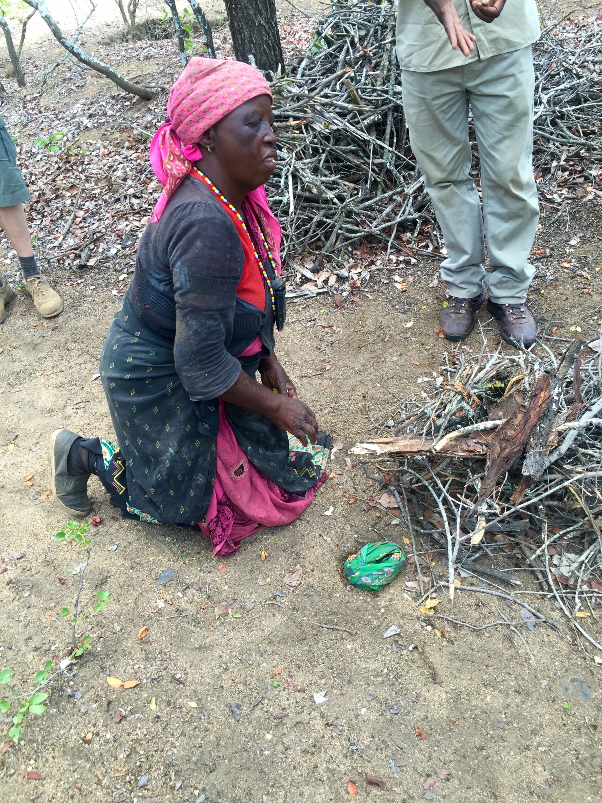
To be shown these things is to be let into something, and there is a respect that is owed in return. Part of travelling this route together is knowing where to walk, when to be quiet, and what not to photograph, so that these places are met with the dignity they still hold, and remain open to those who come after.
Travelled this way, the route becomes less a drive between sights and more a journey through a landscape understood, its history, its cultures and its people met with the people who know them. That is what guiding this route means, and why we do it.

Collect your rental car at OR Tambo Airport and make your way to Bly Bed & Breakfast in Pretoria, a gentle introduction to South Africa. In the afternoon you visit the University of Pretoria Museums in the Old Arts Building, where the golden rhinoceros and the ceramics of the same kingdom can be seen, before the journey north to its origin begins.
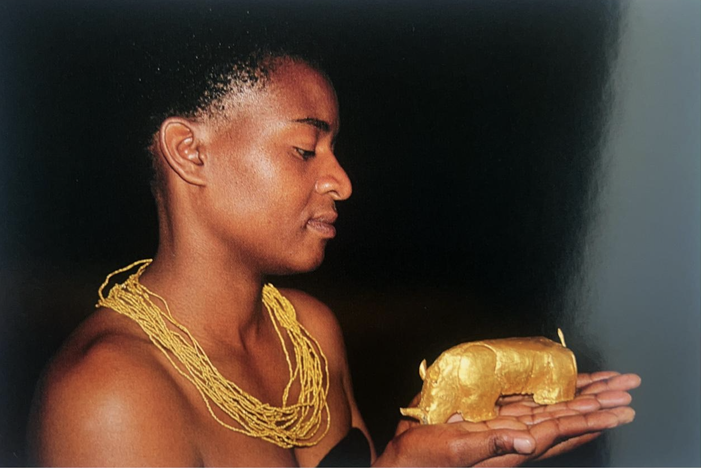
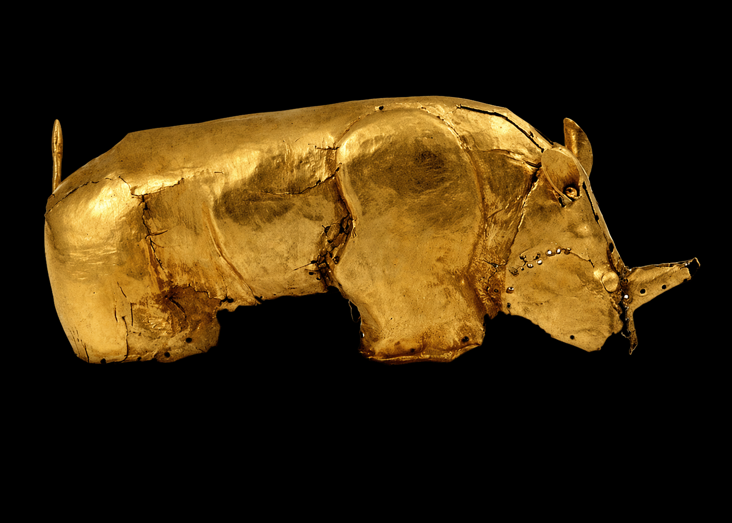
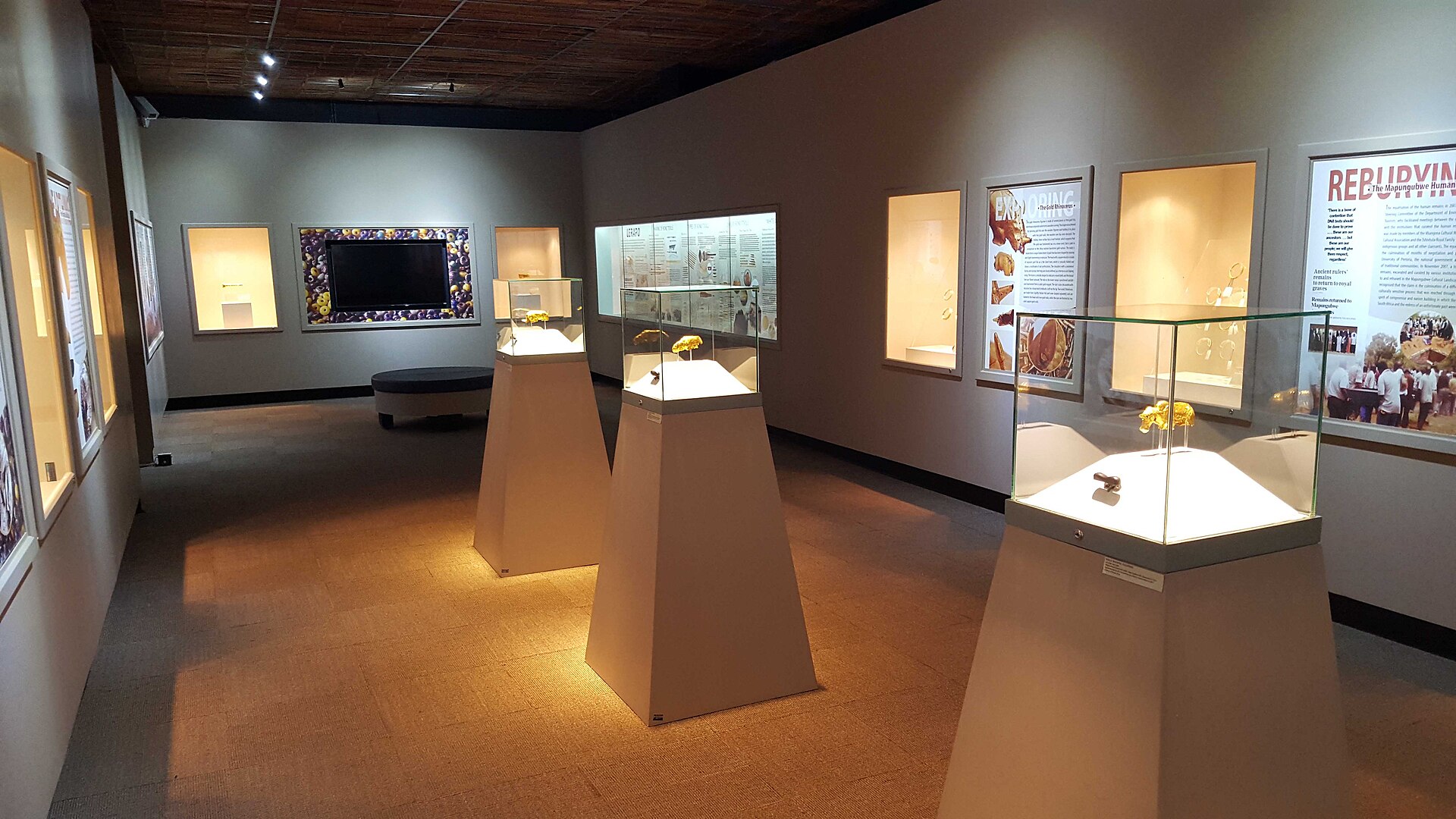
Before you drive north, you can meet the treasure at the source of this whole journey. The famous golden rhinoceros — shaped from gold foil over a wooden core eight centuries ago, and found in a royal grave on Mapungubwe Hill — can be seen at the University of Pretoria Museums, in the Old Arts Building, together with the gold bowl from the same royal grave. In the same museum, the University's Mapungubwe Collection holds over 100 ceramic vessels of the same kingdom (CE 1000–1300) and a rare group of clay figurines.
Pretoria is the only place in the world to stand before this rhino — and to do so on the first day is to carry its image with you to the very hill where it was buried, the very next day. (Displays at the University are periodically rearranged; we confirm what is on view when we plan your journey.)
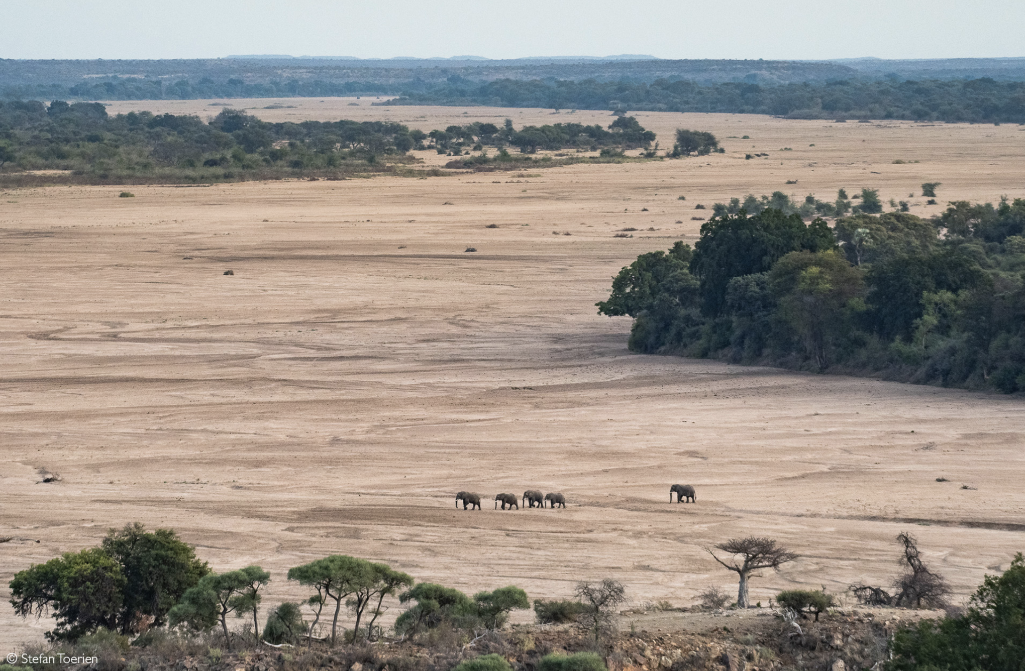
At the confluence of the Limpopo and Shashe rivers lies Mapungubwe, among the first kingdoms in southern Africa to work and trade gold, together with ivory, along the rivers toward the Indian Ocean. Eight centuries ago its rulers sat above a landscape connected, through trade, as far as the coast of China. Today it is a UNESCO World Heritage Site, and the starting point of this journey, two unhurried nights at Mopane Bush Lodge, with game drives in the reserve.
The kingdom is best known for its worked gold, above all the small golden rhinoceros shaped from thin gold foil over a wooden core. It was not found alone. The graves and middens of the hill have given up a wide range of things over eight decades of excavation: gold figures of a bovine and a feline worked in the same way, a sceptre and a bowl, gold anklets and bangles, and thousands of tiny gold beads, together with more than a hundred ceramic vessels, clay figurines, spindle whorls for spinning fibre, and imported glass beads that reached the hill from India and the Arab-Persian world, together with fragments of Chinese celadon, carried inland from the Swahili coast by way of the Indian Ocean trade. What makes Mapungubwe more than a ruin is that its culture did not vanish. It lives on in the Venda, whose land this journey enters a few days later, and in a craft you can still watch being made.

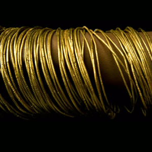
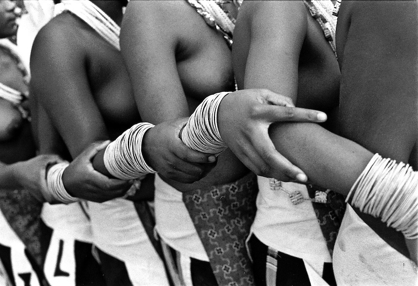
A thread you can hold in your hand. The gold bangles of Mapungubwe were made by drawing and winding fine metal, a technique that did not die with the kingdom. The Venda still make bangles today in a closely related way, a continuity of craft that links the vanished kingdom to a living culture. It is one of the clearest places where the deep past of this corridor can still be seen in the present.

→ The golden rhinoceros & the Interpretation Centre
→ Big-game drive at Mapesu, on the Mapungubwe landscape
→ Sundowner at the Confluence, where three countries meet
Driving east from Mapungubwe, where the Venda land begins, stands the Sagole Baobab, the largest baobab in South Africa and a national Champion Tree, its trunk over thirty metres around and its age counted in centuries. In TshiVenda it is Muri kunguluwa, the tree that roars, and it is held as a sacred place of the ancestors. A brief stop that marks the passage from the world of Mapungubwe into the land of the Venda.
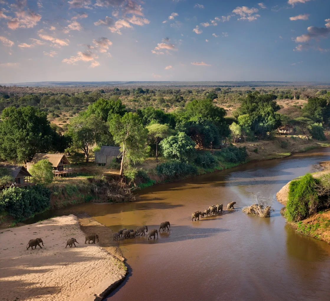
In the remote northern tip of the Kruger, between the Luvuvhu and Limpopo rivers, lies the Makuleke land, the ancestral home of the Makuleke, a Tsonga community. The Tsonga are a people of the south-eastern lowveld and the Mozambican coast, long known as traders who carried cloth and beads inland along the rivers in exchange for ivory, copper and salt — part of the very trade world this route follows. The name Pafuri comes from Mphaphuli, the dynastic name of the Venda chieftains who once held sway over this region. Removed from this land in 1969, the Makuleke had it restored to them in 1998 through one of South Africa’s first successful land-claim settlements, and chose not to resettle but to keep the land under conservation and invest in tourism on their own terms. Your two nights here are at Pafuri Tented Camp, on the northern bank of the Luvuvhu, from which the far north is explored in the company of the community’s own guides.
This is a landscape of fever-tree forests, floodplains and ancient baobabs. Though it makes up only about one percent of the Kruger, the Pafuri triangle is often described as holding close to three-quarters of the park’s biodiversity, and more than 250 bird species have been recorded here in a single year, one of the richest birding regions in South Africa and among its quietest. Above the Luvuvhu stand the stone walls of Thulamela, and at the meeting of the rivers lies Crooks Corner — both visited here, and both explained below.

→ Crooks Corner, at the confluence of the Luvuvhu and Limpopo
→ The Fever Tree Forest along the Luvuvhu
→ Game drives and birding in the remote far north, guided by the community
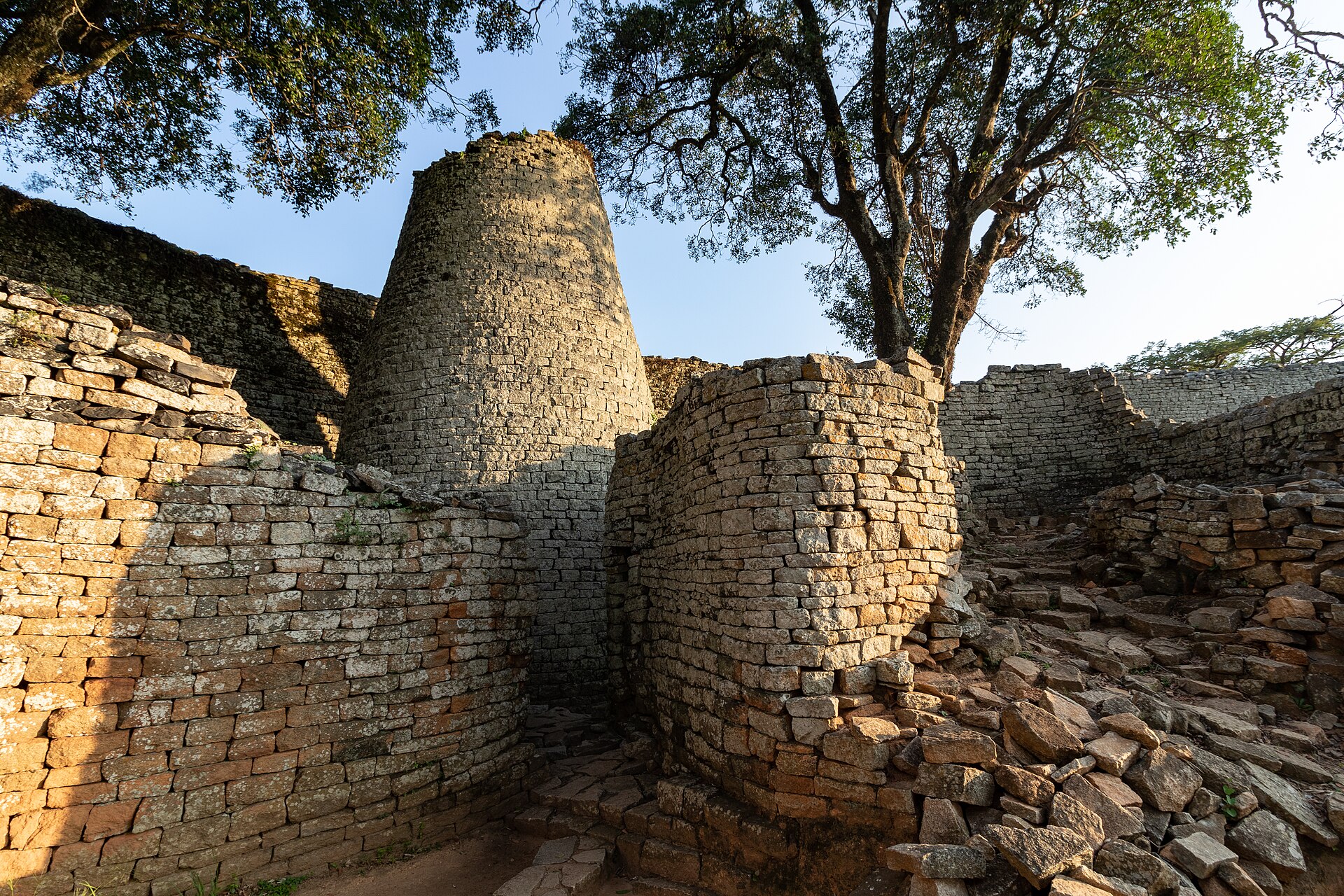
Thulamela belongs to the same world as Mapungubwe, but to a later chapter of it. That world began nearby, at K2 and then Mapungubwe on the Limpopo, where gold and sacred leadership first took shape around 1200. It was one of a wider family of stone-building, gold-trading centres that rose and fell across the region over the following centuries, among them Great Zimbabwe and, later, Khami near present-day Bulawayo. It was from that wider world, around 1550, that groups crossed the Limpopo and founded the walled cities of the Pafuri triangle. Thulamela was one of many, almost every hill here carries traces of that time, and its people worked gold and traded Arab glass beads and Chinese porcelain before the city was abandoned around 1650. The gold and ivory that moved through Mapungubwe moved through this wider world too.
The trade in ivory did more than move tusk. It laid down the routes, the demand and the systems of extraction from which a darker trade in human beings would later grow, a separate history we follow on our Routes of Remembrance.
At the meeting of the Luvuvhu and Limpopo, the borders of South Africa, Zimbabwe and Mozambique converge on a single island in the river. In the early twentieth century this no-man’s-land became a refuge for the lawless, ivory poachers and labour recruiters who could cross from one jurisdiction to another to escape arrest. Among them was Stephanus Barnard, known as Bvekenya, “the one who swaggers as he walks,” who worked the old ivory trail that followed the river down toward the Mozambican coast, the same corridor of trade this journey has traced from Mapungubwe. Near the Makuleke village a memorial his son raised still reads: “In memory of Bvekenya and his wild companions who followed the ivory trail.” It is a place of quiet beauty and hard history, of poaching and of the forced recruitment of mine labour that ran alongside it, and it is visited in the company of a professional ranger from Pafuri.
The road climbs into the Soutpansberg, into the heart of the Venda land, whose living culture carries strong continuities with the world you met at Mapungubwe. Your home for two nights is Camp Fundudzi, a community camp of the African Ivory Route at Mukumbani, from which the village, the sacred lake and the mountains are explored in the company of Venda guides. These two days are the cultural heart of the route: not a site seen from the roadside, but a living world shown from within, on the community’s own terms.
→ The Domba, the linked python dance, shown by the community
→ Sacred Lake Fundudzi and the Thathe Vondo forest, viewed with respect
→ The Tshatshingo Potholes, under guidance
Venda history, oral tradition and material culture preserve strong continuities with the wider Mapungubwe and Great Zimbabwe world, though not as a single unbroken line from one capital. When Mapungubwe scattered around 1300, its idea of sacred leadership did not vanish: related traditions moved north to Great Zimbabwe and, over the centuries, were carried south again into these mountains by Shona-speaking and later Singo lineages who joined with the peoples already here to become the Venda. Much of what took shape at Mapungubwe, a king held apart as a sacred figure, the veneration of ancestors, the reverence for certain hills and waters, is met here as living practice rather than ruin. Oral tradition even remembers a first king, Shiriyadenga, as ruler of both Venda and Mapungubwe. This route approaches that connection through scholarship, community guidance and living practice.
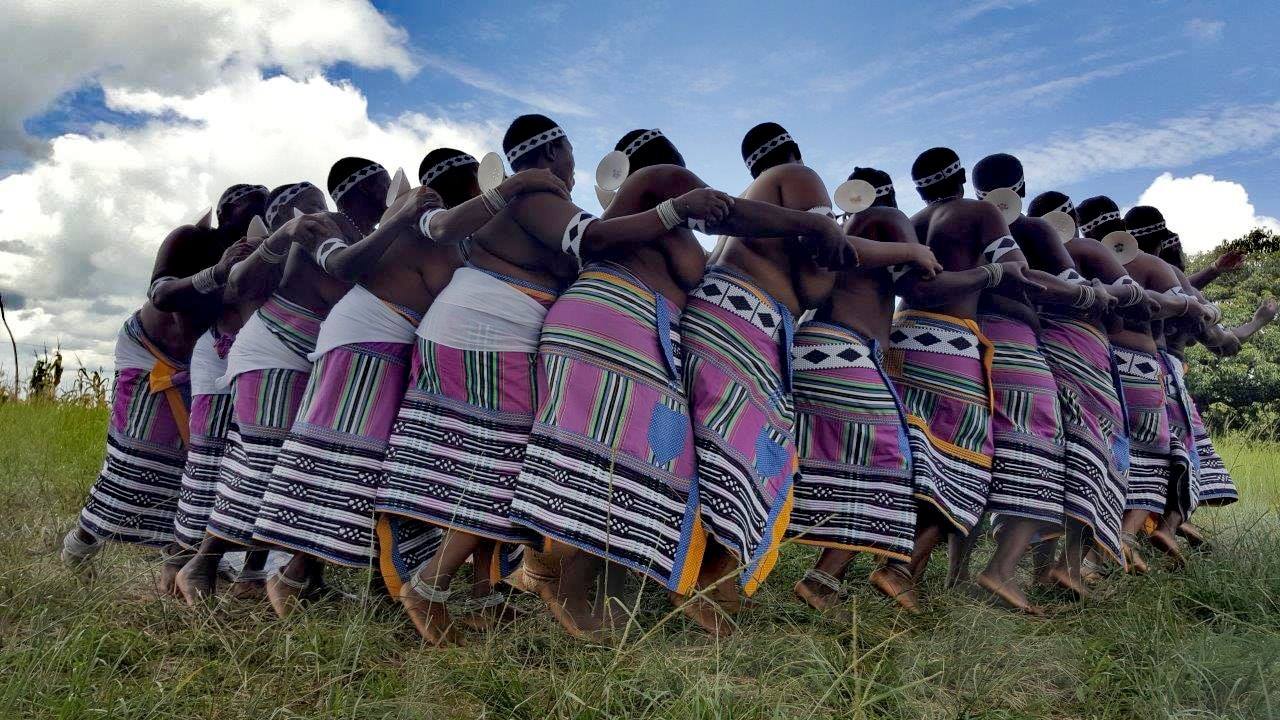

The Venda chapter is the heart of this route, and the reason it exists: a journey developed with the communities themselves, on their own terms.
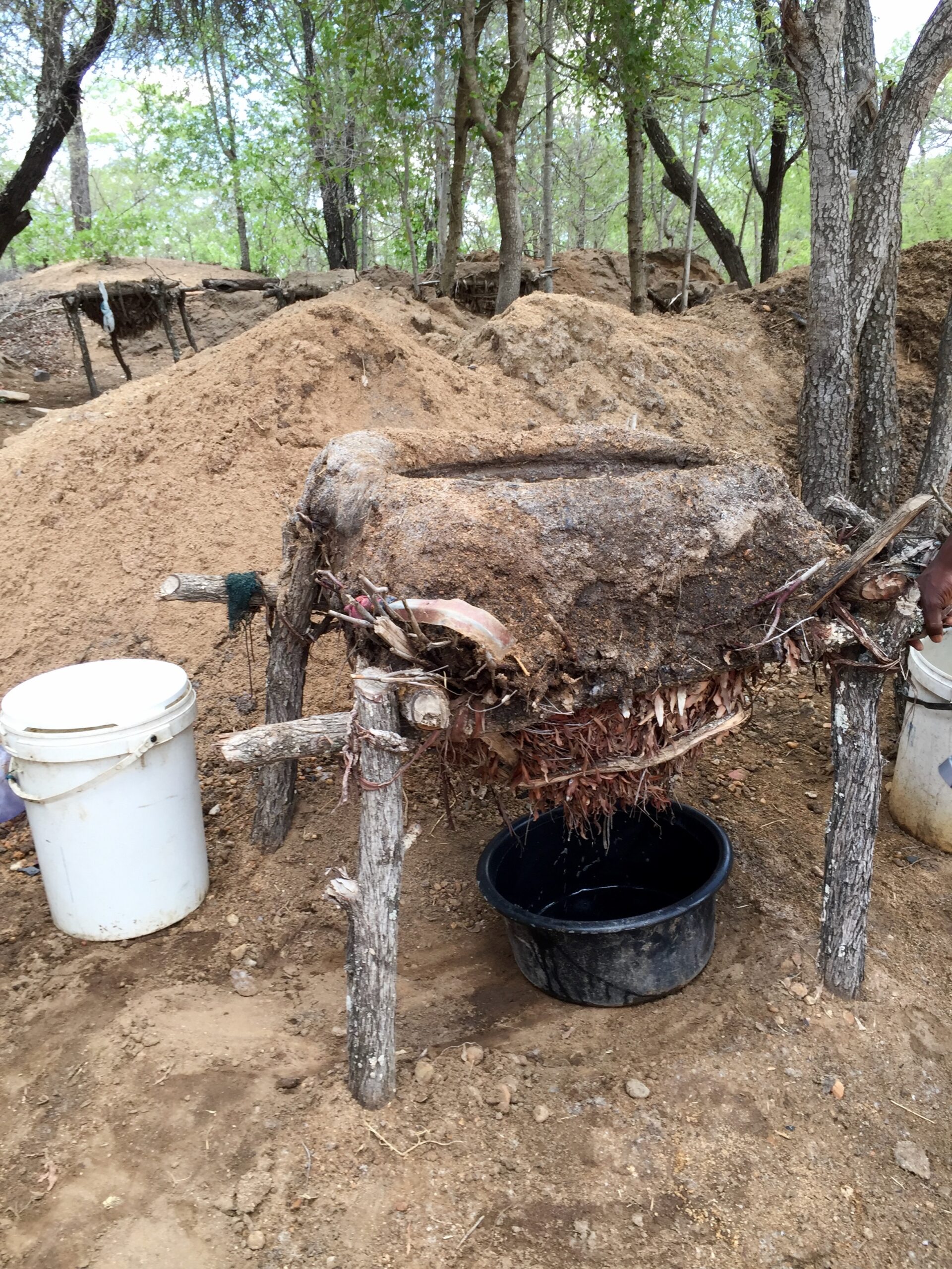
This station joins wildlife with one of the region’s oldest living traditions. Your home is Mtomeni Safari Camp on the Great Letaba, a community-run camp of the African Ivory Route, with tents on the riverbank and meals prepared by the local women. On the way lies Baleni, where Tsonga women have harvested salt from a sacred hot spring for around two thousand years, a spiritual and cultural site as much as a practical one. Letaba Ranch shares an open boundary with the Kruger, in a wildlife landscape known for elephant, buffalo and wild dog.
→ Included guided morning & evening game drives
→ Guided bush walks along the Letaba
→ Riverside dining prepared by the community
Salt was among the goods that bound this region into the wider trade of the interior, alongside the iron of Phalaborwa and the gold of the north, one of the currents from which the kingdoms of this route first grew. Far to the north, across the Sahara, salt shaped trade in the same way, carried south by camel caravan and exchanged for West African gold along the Trans-Saharan routes. The two salt worlds were never linked, but the same principle held at both ends of the continent: salt was a currency that built kingdoms.
On the way south, at the foot of a hill near Phalaborwa Gate, stands Masorini, an Iron Age settlement where the Sotho-speaking BaPhalaborwa mined and smelted iron in the eighteenth and nineteenth centuries. The reconstructed village and its open-air museum show the domed smelting furnaces and the workshops of a community whose iron, worked here, moved outward along the same trade networks that carried ivory and beads. The site was rebuilt by BaPhalaborwa people from the villages bordering the park, a living link to the makers rather than a ruin behind glass. The archaeological record of the Kruger’s Iron Age was first set out by Andrie Meyer, emeritus professor of the University of Pretoria and the academic advisor of SCE. Masorini is an optional stop, visited on the game-drive route south.

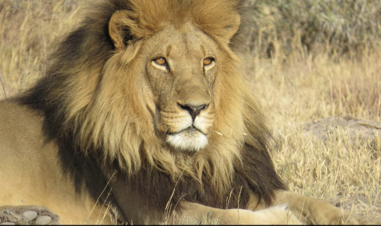
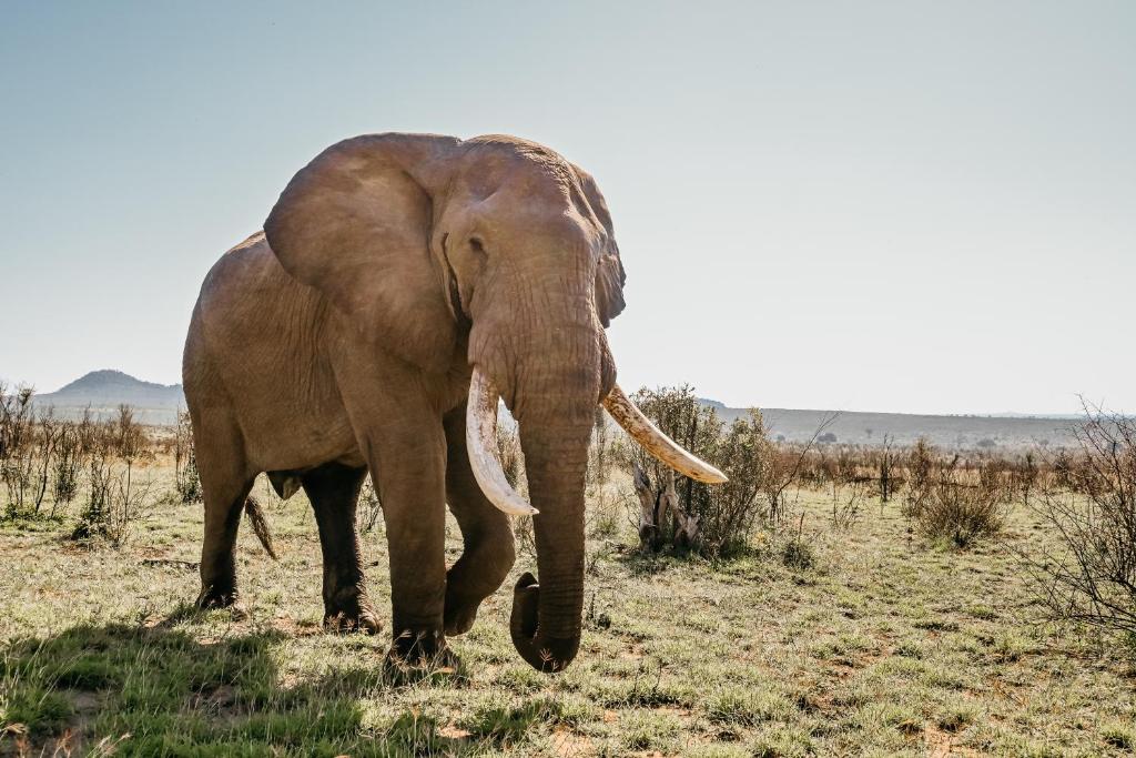
Manyeleti is a private reserve lying within the greater Kruger ecosystem, unfenced from the national park, so that wildlife moves freely between them. It is renowned for its game viewing, often the Big Five in a single day, without the crowds. Its name means "Place of the Stars" in Shangaan. It carries a history few of its neighbours share: during the apartheid years, when the Kruger was closed to black South Africans, Manyeleti was the one reserve where they were permitted to experience the bush. This is the ancestral land of the Mnisi, a Tsonga community, who lived here for generations before being removed in the last century, the same Tsonga world you have travelled through since Pafuri. Today the land is held for conservation on the community’s own terms, and the lodges and camps within the reserve operate as concessions that pay back into it. It welcomes everyone now, and has kept its quiet, uncrowded character. The drive here is itself a highlight: a game-drive day through the Kruger, entering at Phalaborwa Gate and leaving at Orpen Gate. Because Manyeleti keeps its own entrance, you leave the park briefly at Orpen and enter the reserve through its own gate, a short step from one to the other, though no fence divides the animals.
→ Guided morning & evening game drives
→ Bush walks with armed rangers
→ Night drive for nocturnal species
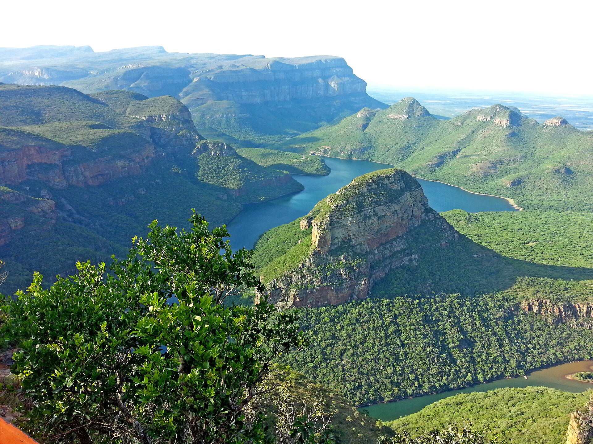
The wildlife gives way to one of the country's most beautiful drives, a scenic close to the journey rich in natural heritage. From the Graskop Hotel, a boutique art hotel where every room is the work of a South African artist, explore the edge of the escarpment where the Highveld falls away to the Lowveld, the four great viewpoints of the Panorama Route among them. From here the route turns south, down off the escarpment and back into the Kruger for a final day in the park.
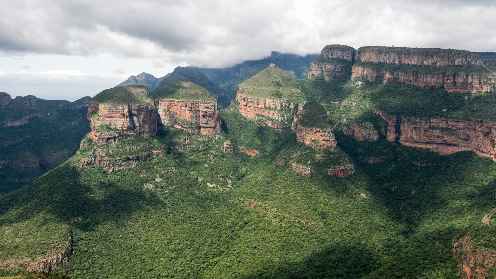
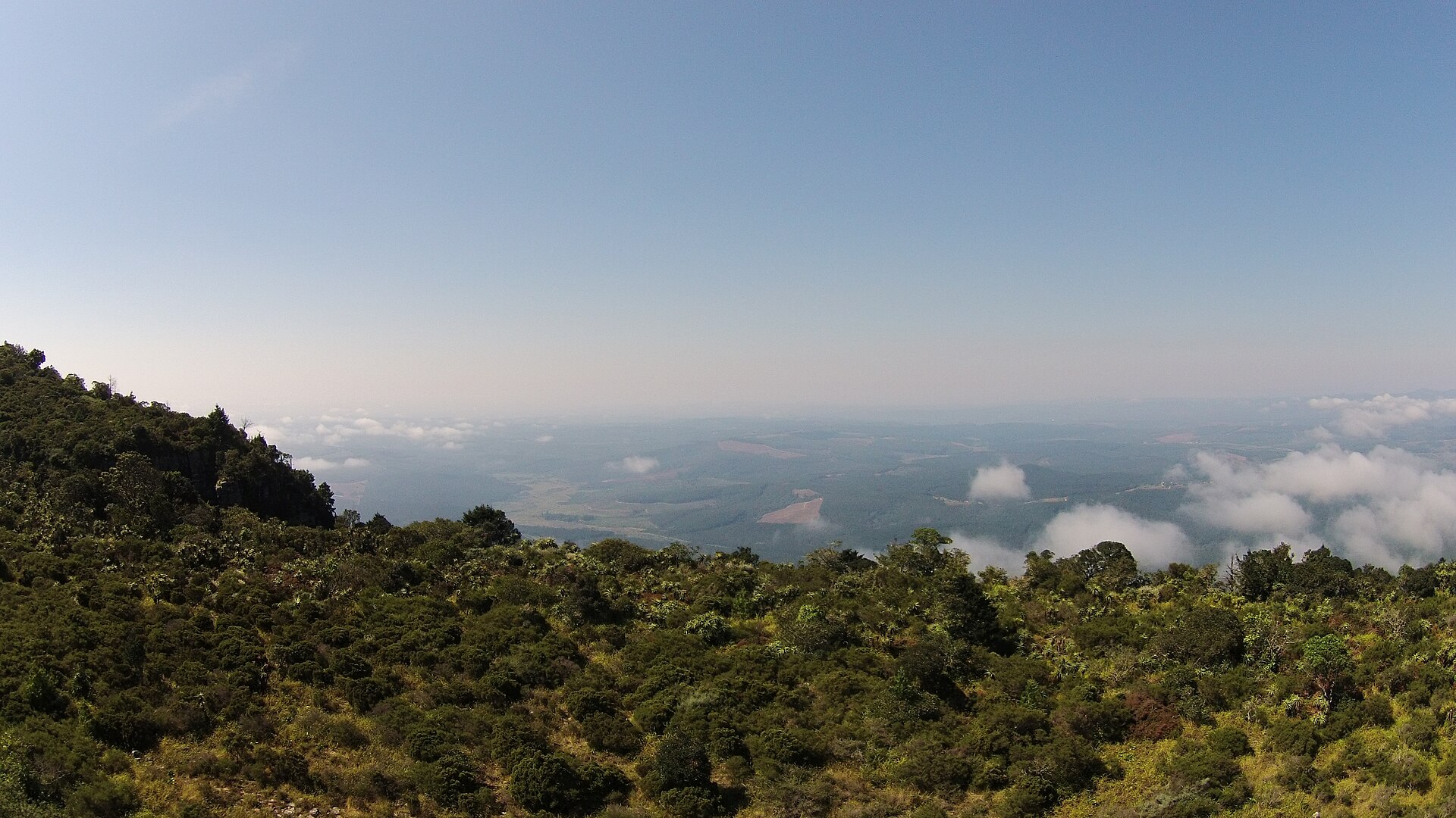
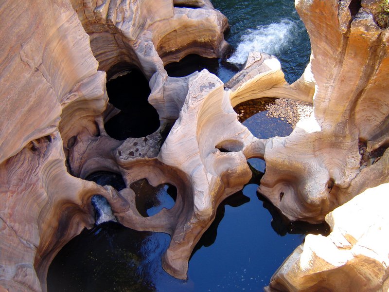

From Graskop the road drops down off the escarpment towards Hazyview and the Phabeni Gate, where the ruins of Albasini’s trading post mark the harder history of this corridor. From there it is a short way to the Numbi Gate and your final night inside the Kruger, at Mdluli Safari Lodge, on community-owned land on the park’s western edge, with a last game drive in Big Five country. The following morning an easy drive returns you to OR Tambo for your flight home.
→ The ruins of Albasini’s trading post at Phabeni Gate
→ Last night at Mdluli, on community-owned land
→ Return drive to OR Tambo
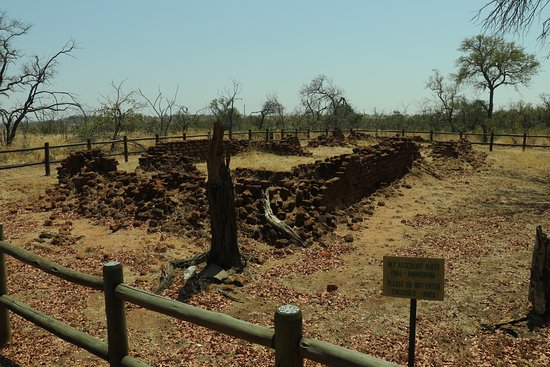
At Phabeni Gate stand the remains of the trading post established in 1845 at Magashula’s Kraal, an early European foothold in the lowveld. Its builder, João Albasini, grew wealthy on the ivory that had long moved through this country, trading beads, cloth and knives inland for tusk along two ancient trade routes. But his story belongs to the harder history of this corridor, not its romance. Here the two trades were not separate: the same frontier that moved ivory also moved people. As Native Superintendent and commandant in the Soutpansberg, Albasini stood at the centre of the inboekstelsel, the system under which African children seized in commando raids were registered as “apprentices” and held, bought and sold, a practice historians regard as slavery in all but name. On this frontier the capturing and selling of children was not incidental to the hunt for ivory but a supplement to it, and the people of the time named it exactly: swart ivoor, black ivory, traded alongside the tusks. This was the pattern that ran through the ivory trade across much of Africa: the commerce in ivory and the coercion of human beings grew from one system, and cannot honestly be told apart. The post is kept here as history, not homage. That human story is not a footnote to the trade in goods; Southern Cross follows it as its own, as the memory it is owed, on the Routes of Remembrance.
Indicative accommodation, chosen for location, character and their relationship with conservation and community. Final accommodation is confirmed during private route design.
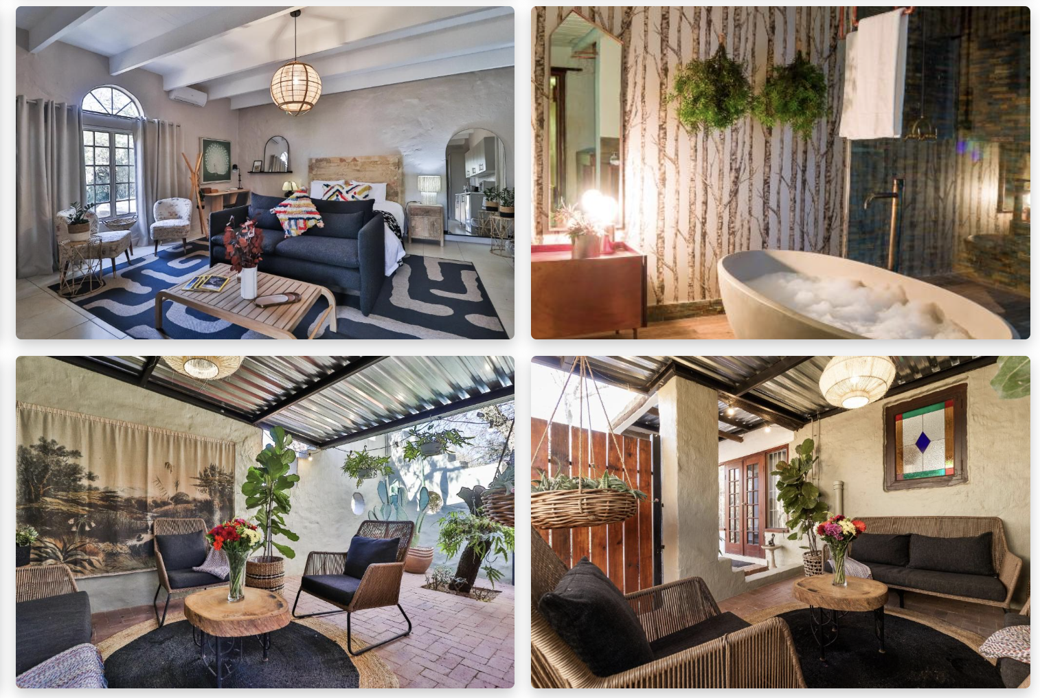
A welcoming guest house a few minutes from Pretoria, a gentle landing after the long flight and a calm base for the first night before the drive north.
A gentle start ¾
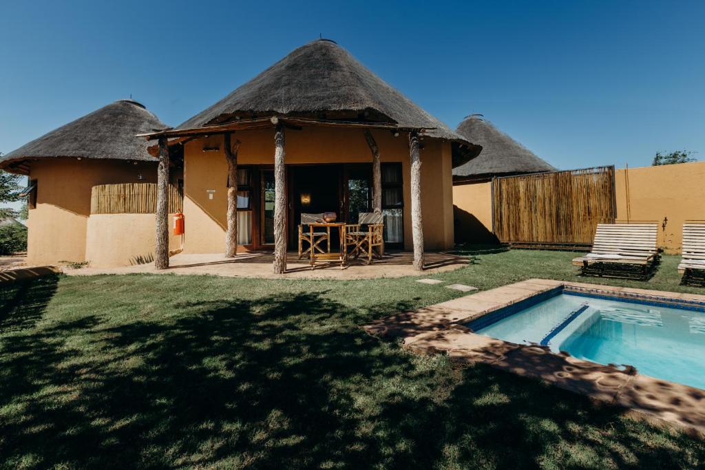
A warm, owner-run lodge of thatched chalets on the Mapesu Private Reserve, at the gateway to the Mapungubwe World Heritage landscape.
Conservation ¾

A tented camp on the northern bank of the Luvuvhu, on the Makuleke community's own land in the far north of the Kruger. Your base for two nights in the Pafuri triangle, from which the fever-tree forests, Thulamela and Crooks Corner are explored in the company of Makuleke guides.
Community-owned land ¾
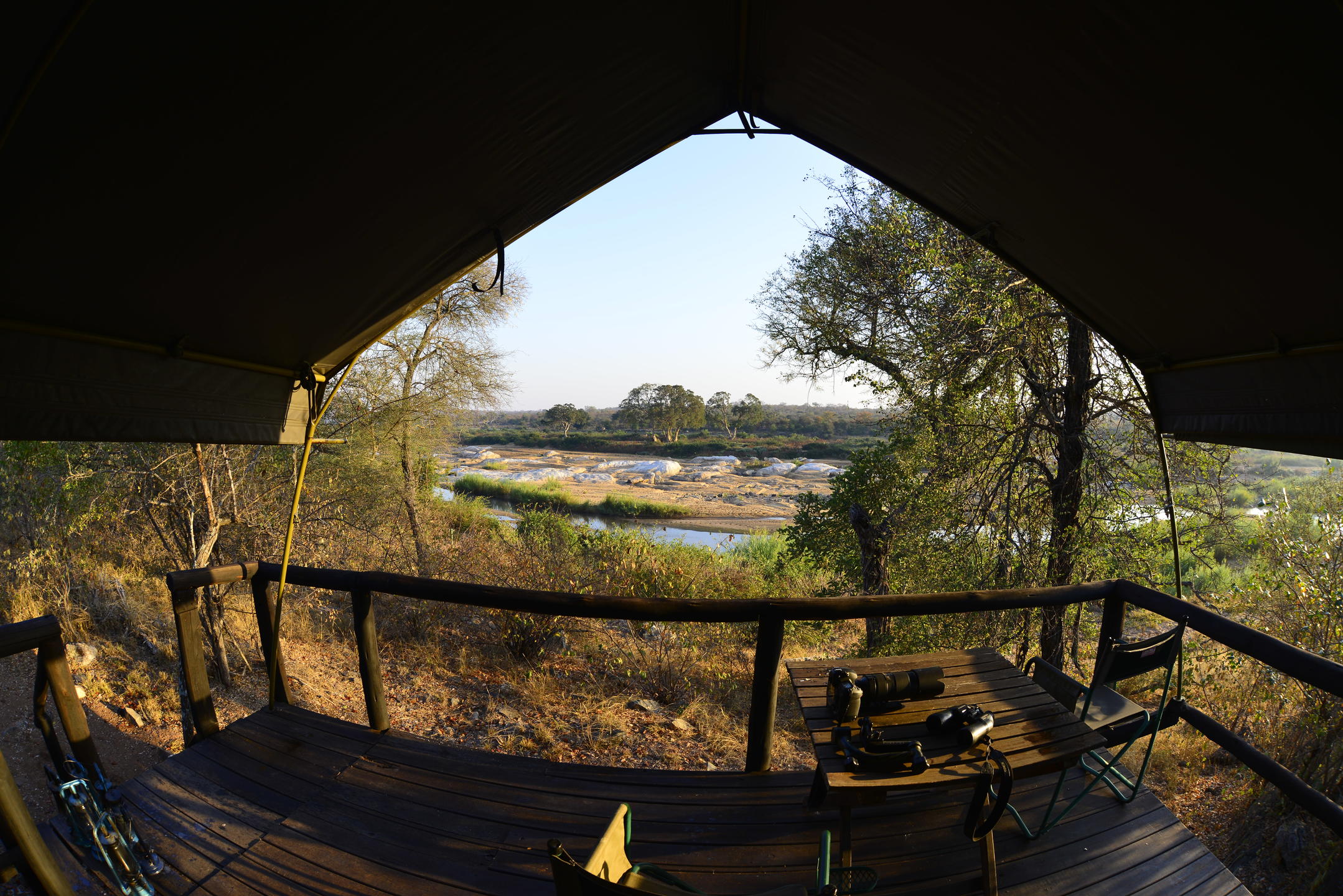
A community-owned camp on the Great Letaba, with tents, gas-heated showers and riverside dining. An African Ivory Route camp in the truest sense. Mtomeni is included subject to final operational confirmation by the African Ivory Route owner cooperative; where it is unavailable, an equivalent Letaba or Greater Kruger camp is arranged, keeping the Baleni and trade-route chapter intact.
Community-owned ¾

An intimate camp in the heart of Big Five country, with an excellent kitchen and only a handful of tents, away from the crowds.
Community benefit ¾
A boutique art hotel in the heart of Graskop, its Artist Rooms each the work of a contemporary South African artist, with home-style dining and a fireside lounge.
Local culture ¾
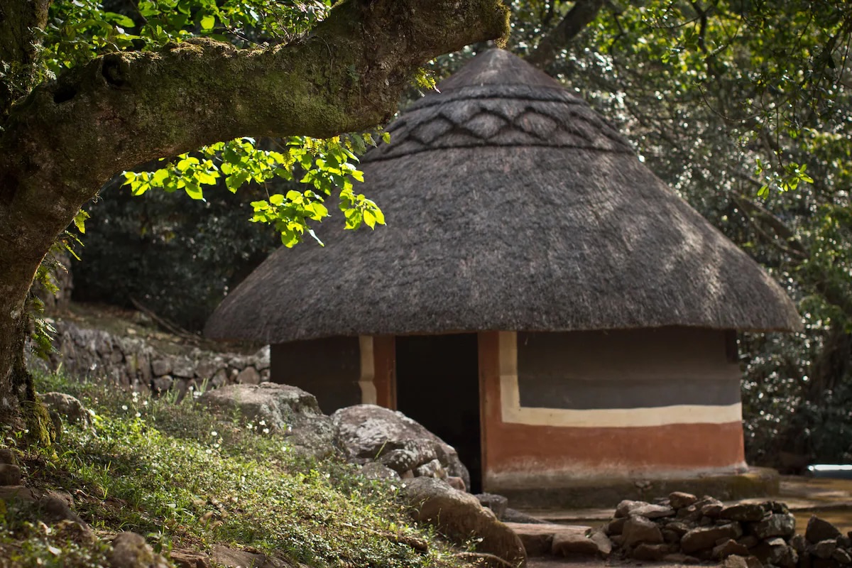
A community camp in the Soutpansberg, in the Venda land at the heart of its living culture.
Community-owned ¾
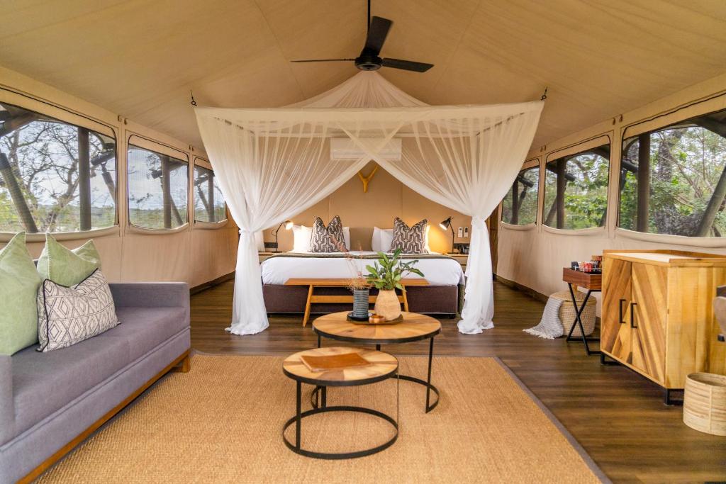
A tented lodge within the Kruger itself, on the Numbi Gate side of the park, its canvas-and-timber tents set on land the Mdluli community reclaimed and now hold. Your closing night is inside the park, with a Big Five game drive from the door and the Panorama escarpment just behind you.
Community-owned land ¾

These are indicative examples, confirmed during private route design. Each place is chosen for where it sits on the route, for its character, and for its relationship with the communities and the conservation work around it, never for a label alone.
Travel dates, group size, vehicle choice and extras determine the final price. We are happy to provide a no-obligation quote.
Request a QuoteThis is a guided self-drive journey, travelled as a small group on set dates. You drive your own vehicle, with the founders of Southern Cross guiding the way. The route, the pace and the sequence are set so that the community welcomes, the Venda-guided visits and the remote camps of the far north can be woven together as they are meant to be experienced.
The route includes two longer driving days: the arrival leg from Pretoria to Mapungubwe, around five and a half hours, and the final leg from the southern Kruger back to OR Tambo on the last morning, around four and a half hours. Where the group would prefer a gentler pace, either leg can be broken with an overnight stop along the way.
Each departure is a small guided group. Private departures on your own dates can also be arranged.
The guided departure above is the way this route is usually travelled. For those who would prefer to travel on their own dates, a private version of the same journey can be arranged for small groups, subject to guide availability, community access, camp availability and seasonal road conditions. The stations, the pace and the accommodation can then be shaped around you, and the route can be shortened, extended or combined with another Southern Cross journey.
This journey traces the southern reach of a far older network. It forms part of the wider Ancient Trade Routes of gold and ivory that once linked the interior kingdoms of southern Africa to the Indian Ocean World, and can be read alongside the other routes in that family. The same corridors carry a second story, of the people who moved along them, told in our Routes of Remembrance.
Contact us for the dates of the next guided departure along this ancient trade route, travelled as a small group with the founders of Southern Cross.
Enquire Now